Focus+Context Route Zooming and Information Overlay in 3D Urban Environments
Huamin Qu2
Haomian Wang2
Weiwei Cui1
Yingcai Wu1
Ming-Yuen Chan2
1Microsoft Research Asia
2Hong Kong University of Science and Technology
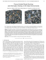
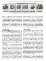
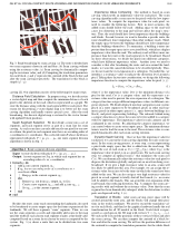
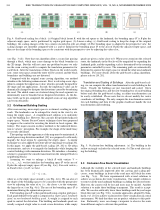
In this paper we present a novel focus+context zooming technique, which allows users to zoom into a route and its associated landmarks in a 3D urban environment from a 45-degree bird's-eye view. Through the creative utilization of the empty space in an urban environment, our technique can informatively reveal the focus region and minimize distortions to the context buildings. We first create more empty space in the 2D map by broadening the road with an adapted seam carving algorithm. A grid-based zooming technique is then used to enlarge the landmarks to reclaim the created empty space and thus reduce distortions to the other parts. Finally, an occlusion-free route visualization scheme adaptively scales the buildings occluding the route to make the route always visible to users. Our method can be conveniently integrated into Google Earth and Virtual Earth to provide seamless route zooming and help users better explore a city and plan their tours. It can also be used in other applications such as information overlay to a virtual city.
Focus+Context Route Zooming and Information Overlay in 3D Urban Environments from Yingcai Wu on Vimeo.
Download the complete video (24MB)
@article {YWu2009c,
author = {Huamin Qu and Haomian Wang and Weiwei Cui and Yingcai Wu and Ming-Yuen Chan},
title = {Focus+Context Route Zooming and Information Overlay in 3D Urban Environments} ,
journal = {IEEE Transactions on Visualization and Computer Graphics},
year = {2009},
volume = {15},
number = {6},
pages = {1547--1554 }
}

